Ancient and new trails with dizzying vistas
We walked the oldest known “road” of the island on the second day of our hiking trip and had a beautiful wild beach all for ourselves. On the third day we followed a much younger road that was never used as originally intended. Then on the last day we did two days’ distance in one.

We started the second day in the crater with a couple of sandwiches and a Turkish coffee (no, we couldn’t use the heat of the volcano). The morning was a bit cool and cloudy and everything was wet of dew but my family is lazy enough so by the time they got up, our things were dry again.
We left the crater where the liquid lava once poured out to create the malpaís (badlands) around it and then followed the dirt road uphill. This part of the island is a patchwork of good-for-nothing barren lava flows and small farms that people tediously created over the centuries. Many of these are now out of use and in spring they sport green grass and all sorts of meadow flowers. We passed some abandoned farms and climbed a few old stone walls before we found another proper road that took us to Yé.

A short break in Yé
Lanzarote has a number of short town names like Soo, Tao or Uga but none of them beats Yé, a village at the foot of the Corona volcano. Perhaps the island is too narrow at this point for a longer name… In the past (which means before tourism took off in the 1960s in case of Lanzarote) it was a poor village and many of its dwellers left to find a better life elsewhere. Even today it’s a very quiet place with little traffic on weekdays (at least in 2021!)


We had a coffee at the bar that also functions as a grocery and then filled up our stock because we knew there’d be no more shops for the next two days. While we were there, we made friends with a cute cat and it was probably the source of the lice we could only get rid of a week later…
The path of the dead
As we leave the village we walk past the white church and a complex of traditionally built houses with the usual cystern, the aljibe. It’s an easy walk along the sealed road to the parking place of the mirador, the viewpoint of Ye. This place offers amazing views of the mountain, the ocean and the islands of the Chinijo archipelago, with La Graciosa in the foreground. From this point, a dizzying path zigzags down to the bottom of the Risco.


What is now used by hikers and tourists was built manually hundreds of years ago by the people of Lanzarote. It is called Camino de los Gracioseros for a macabre reason. It was used by the inhabitants of the smaller island to transport their dead to the cemetery of Haría.
We found the water, the wine and the food we hid among the rocks two days before. After arranging everything in the backpacks we descended slowly to sea level. The original plan was to camp near a ruined fishing village but in the end we chose the wide sandy beach opposite La Graciosa.
A night on the beach
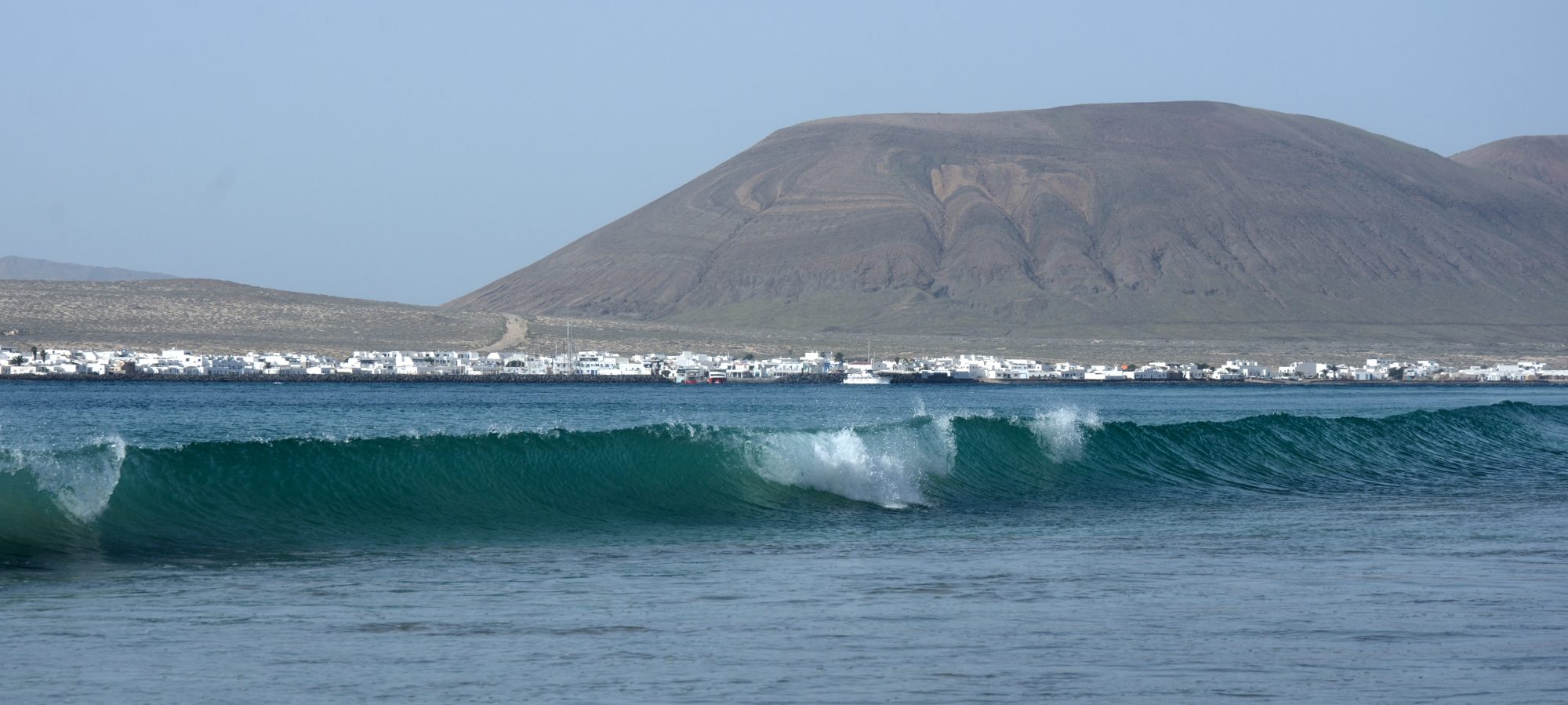
Lanzarote is a windy place and this wind is a blessing and a curse at the same time. Without it, the island would be intolerably hot but this is why grapes and fruit trees need to be protected with stone walls. Many of the sandy beaches are also dotted with circular stone walls, the so-called goro, where people can enjoy the sun without the wind filling everthing with sand.
We chose one of these protected places to put up our tent and spent the rest of the day body-surfing in the waves. Then came dinner time and the gas cooker I bought some 25 years ago still worked fine. It was a beautiful starry night.


A road never completed
If you look at the dramatic range of the Risco from the beach or one of the viewpoints, it seems like dangerously steep rock face that’s impossible to climb. In fact, local people used several routes to reach the sea or the islands. Or the salt pits near the northernmost tip of the island. Salt was produced for generations at Salinas del Rio, which were abandoned in 1970. We started the third day of our trip with a visit to this magical place, the home of birds these days.


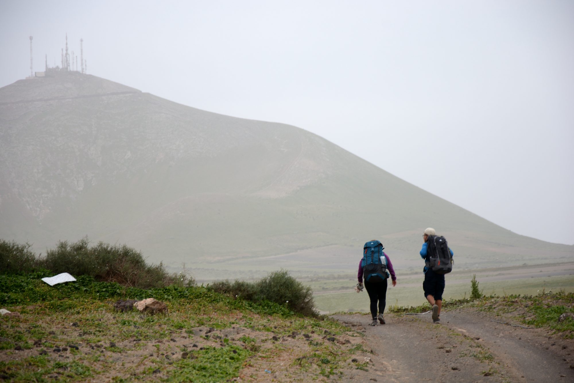
Most of the old paths are now forgotten and abandoned and only the path I mentioned above is an official hiking trail. However, back in the 1960s a plan was approved to build a road between Famara and the beach facing La Graciosa in order to boost tourism on the smaller island. Construction work started and the route was cleared but then the project was scrapped. The reason was the danger of falling rocks and risky bends as the environment was less important those days. Lucky for hikers, as the long and hard route is among the most spectacular of Lanzarote.

The path slowly climbs to around 200 metres, the middle of the rock face. Then we follow the twists and turns of the cliffs, formed by the elements. At places it can be tough or even risky where the path is covered in rocks or where it simply disappears due to the rainfall. But if Anita could do it with her fobia of heights, anyone can do it.


We arrived in Famara, I mean the end of the long wild beach, by around 5. We still had time to play with the powerful waves before we set up our tent on the sand where there was no vegetation. A friend came to visit us from Playa Honda, bringing ice cold beer and cola with her.
Spring water!
In the morning we felt fresh and full of energy so Aron and I decided to take a detour to the casa del agua, the place that used to provide water for this part of the island. It’s 7 km altogether along a spectacular route like yesterday. At the end of the road there’s a rickety hut, partly redecorated. They say a troubled woman moved in many years ago. We are greeted by her dog; it barks angrily but after a few kind words we are friends.


Then we look for the room where sweet water pours from the mountain through a pipe into a sizeable pool, then down the stairs into the ocean. We must taste it though we forgot to bring bottles. I had drunk something similar in Transsylvania many years ago. It has a special taste but we really like it.
Changed plans
We got back to the tent, packed up quickly and walked to the village of Famara for a coffee and some food for the day’s hike. The wind was stronger but it was a sunny day. After a short break we headed back to the beaches and then followed the signposted trail that leads up to the Morro Alto.

The route is only a few kilometres long but exciting it is! We walked up along a barranco, a very deep gorge that only sees water after the winter rains. Then we climbed higher to reach the pass. It’s only 325 metres above sea level but it feels like a high mountain pass with the line of rocks vanishing in the haze.

You can take the easy route from there along a wide valley or walk still a bit higher before descending to the old capital of the island, Teguise. We opted for the latter, ate our sandwiches at the highest point and then a beer in a bar in the old town centre.


It was then that the weather suddenly changed. Clouds covered the sky and the wind got stronger. I checked the forecast on my phone. The wind now blew from south-west, which means a high change of rain. Finally, we agreed we’d best skip the last stop under the castle of Teguise and walk as far as we could before taking a bus home.
We picked up the food we left near the planned camp and then followed dirt roads as far as San Bartolomé. We arrived there in the dark, totally exhausted. This last section was the most difficult with strong head wind carrying fine sand – the masks came handy now. The total distance was more than 30 km for the day.
Share this content: